apps4nsw Wrap up
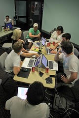
On Saturday, we had the privilege of running apps4nsw, for the DSTA, the NSW Department of Services, Technology and Administration, at the Powerhouse Museum. Over 150 developers, designers and others turned up from 8am for 12 hours of brainstorming, app building, presentations, and prizes. More than 40 projects were entered for judging in 5 categories, all using NSW Government data, but running on all kinds of devices, from Android to iOS, and of course a great many web apps. It was a great day all round – check out JJ Halans’ photoset on Flickr.

Real time bus location data proved a very popular source, with a dozen or so apps built using the RTA’s PTIPS data.
Also very popular was a brand new data set – only released the afternoon before – featuring information on all the pets in NSW. So popular was this data, we decided to create a special prize category just for it!
Overall winner of the day, and winner of the Transport Category was Next Bus, which like a number of the transport apps, helps you find the nearest busses to you in real time. You’ll never have to look at a time table again!
Congratulations to all the winners and prize getters, and a huge thanks to the various NSW government departments making their data available – and here’s to much more of it in the future.
Energy/Environment Category
Winner
- Cats and Dogs
- Simon Wright, Tai Elliott
- Used NSW Stormtracker data
- Tells you if you need an umbrella if you are going outside (a great, fun experience)
2nd Place
- Shape of my Burb
- Andrea Lau and Jack Zhao
- Used the BASIX dataset – Building Sustainability Index Data
3rd Place
- Excess Energy
- Joel Courtney
General Category
Winner
- Suburb Search
- Sam Gentle
- ABS data
2nd Place
- Hot and Healthy
- Raul Caceres
- Used: NSW Health Survey program
- Uses the data to present a visualisaiton of how healthy your local area is, feeds in information to help you find local gyms and parks etc.
3rd Place
- Data Loco
- Eric Bae and Xiangwei Meng
- An app that makes it easy for anyone with any data that has location info in it to upload this data and then visualise it on Googlemaps.
Companion Animals Category
Winners
- Petrified
- Alfred Lo, Steven Ringo, James Martin, Ralph Lengler, Valery Yuschenko, William Parry
- NSW Companion Animals Register
- Overly of pet data on Google maps so you can quickly see how popular names and dog types are.
2nd Place
- Doggie Wars
- Tim Lucas, Lisa Miller, Brett Goulder, Carl Woodward
- API for the data – a clean reusable interface for the data for all developers to use. Doggie Wars is a fun way of looking at numbers of each breed across the state.
3rd Place
- Dog Guide
- John McCann, Luke Du, Peter Pham, AJ Dyka
- Data visualisation so people can see dog names are most popular by breed.
Spatial Category
Winners
- Topolive
- Matt Mcclelland
- Renders a NSW topographical map on Google Earth, Generate Tographical maps for offline use on the iphone
Equal 2nd Place
- Spot It
- Corey Rosevear
- Display information for a specific location – layering data over LPMA maps.
Equal 2nd Place
- Fancy PDF
Transport Category
Winners
- Next Bus
- Chris Broadfoot, Luke Mahe
- Find out what buses are coming to a stop near you.
2nd place
- Tripmate
- Dan Aschwanden
- Smartphone app – Live data for buses displayed graphically on a map
3rd Place
- What bus?
- Graham Weldon
Great reading, every weekend.
We round up the best writing about the web and send it your way each Friday.
